Smarter Routes.
Continuous Monitoring.
Clear Priorities.
i-Cetech Unified Geospatial Solutions is a map-first decision platform that links route optimization and predictive monitoring in one workflow. Plan corridors with transparent trade-offs, then operate with explainable events and prioritized actions.
Core Use Cases
Built around how pipeline teams work: plan corridors, monitor operations, and act with clear priorities.


Three Products. One Integrated Workflow.
Plan corridors, operate with monitoring, and keep decisions traceable.
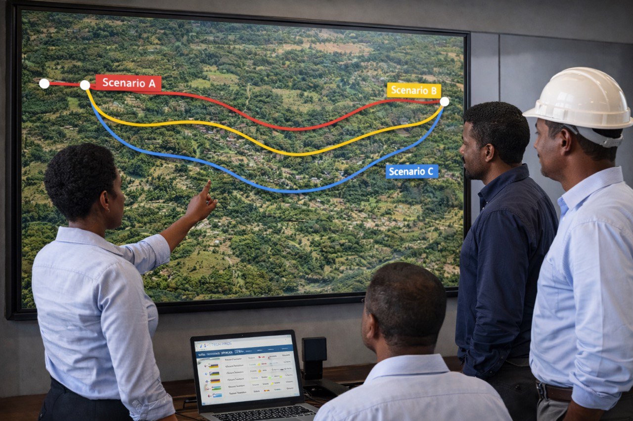
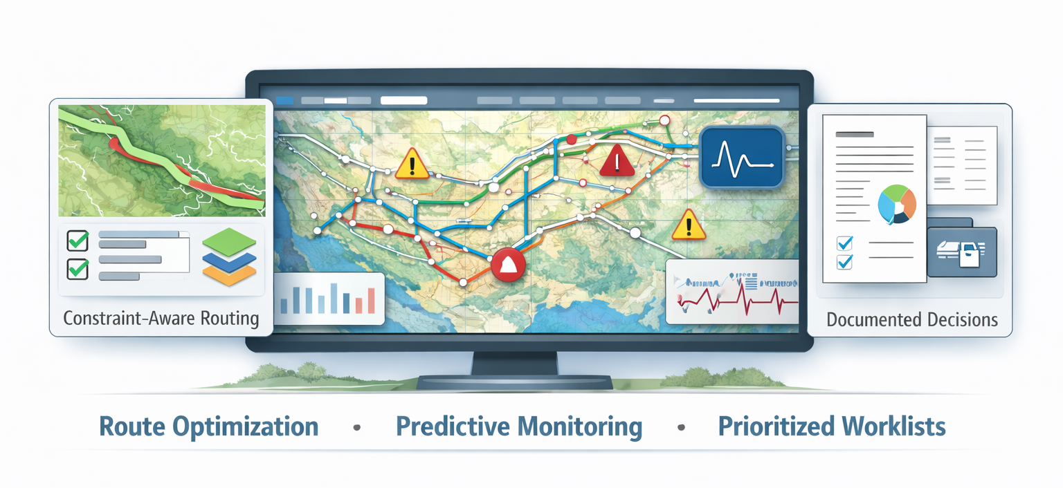
Route Optimization
Multi-criteria routing that evaluates terrain, land cover, protected areas, crossings, and constructability. Compare scenarios with corridor KPIs that make trade-offs clear.
- Constraint-aware corridor generation and ranking
- Exposure summaries for land cover, water, settlements, and protected zones
- Export-ready maps and scenario packs for stakeholder review

Real Time and Predictive Monitoring
Event-based monitoring with clear severity logic using exceedance magnitude, trend, and persistence. Review issues remotely, reduce noise, and prioritize response.
- Event table with filters, timestamps, and asset references
- Severity that is interpretable for operators and engineers
- Traceable actions with records and exports for handover
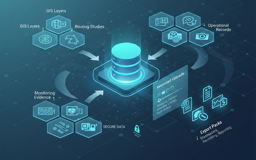
Unified Data Management System
A centralized, database-backed workspace that organizes routing studies, monitoring evidence, GIS layers, and operational records in one secure, traceable system, so teams can find, trust, and reuse the right data fast.
- Structured data model for assets, corridors, events, inspections, and documents
- Versioned uploads with metadata, lineage, and audit-ready change history
- Export packs (maps, tables, PDFs) for stakeholders, permitting, and reporting
Advanced Technologies
Practical AI with transparent logic, map context, and a built-in document workflow for traceable delivery.
FAQ
Short answers to common evaluation questions.
For routing, you need a DEM plus constraint layers such as land cover, protected areas, settlements, crossings, and right of way rules. For monitoring, you need time series readings with sensor IDs and locations.
Severity is based on clear indicators such as exceedance magnitude, persistence over time, and trend direction. This supports remote review before dispatch.
PROS supports a document workflow for scenario packs, maps, reports, and inspection evidence. Outputs can be exported for stakeholder review, handover, and internal reporting.
Yes. It is designed as one workflow. Plan corridors with corridor analytics, then monitor and prioritize actions using the same map and asset context.
Ready to see the solutions in action?
We will walk through the route optimizer and predictive monitoring dashboards using your workflow assumptions.